
The summer of 2016 brought an unprecedented and unwelcome event to the waters of Utah Lake. A massive algal bloom spread across the lake, eventually encompassing ninety percent of its surface, causing local health officials to close the lake for several weeks to all recreational use.
Algal blooms are naturally occurring, and nothing new to Utah’s waterways. The concern is these blooms are growing more extensive, lasting for longer durations, and can host strains of toxic cyanobacteria that can cause a variety of symptoms ranging from skin irritation, to respiratory infections and nausea in humans, in addition to being harmful to livestock.

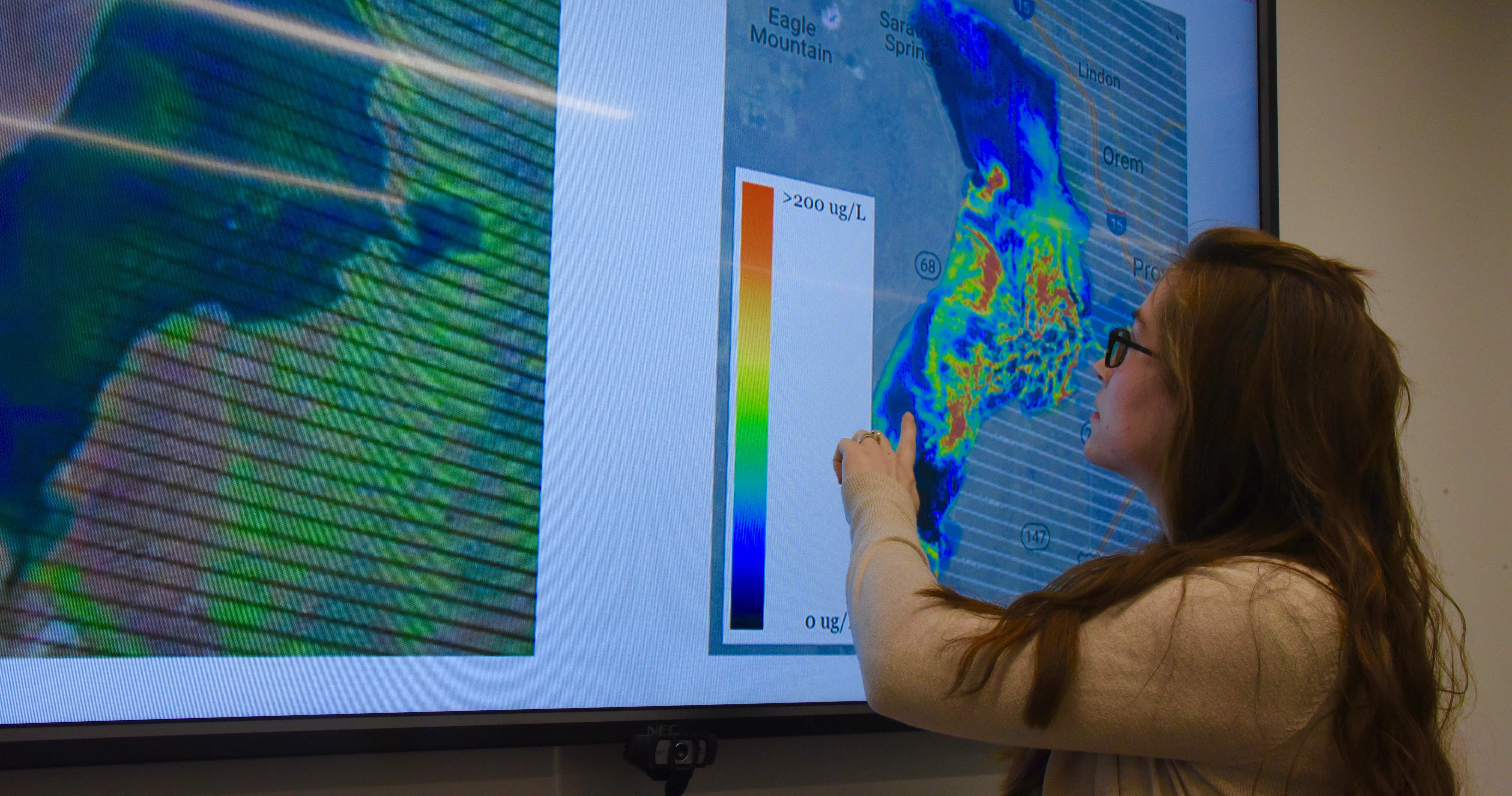
University of Utah researchers are working to track the growth and development of these blooms in an effort to better understand the forces at work, and what can be done to mitigate any negative effects on human health and the local community. Among these researchers is Carly Hansen, a PhD student in civil and environmental engineering. Carly’s research is focused on using remote sensing and satellite technology to create an historical record of the growth and development of these algal blooms over a period of decades.
“Remote sensing is the big umbrella,” Carly explains. “It has really allowed us to expand the lens of monitoring.” The data set she is using in her research goes back to 1984. “My idea was to start looking at what happened in the past, and use that information to better inform our understanding of current conditions. We have definitely seen an increase in extremes.”
By analyzing a vast store of satellite data, Carly hopes her work will provide clues to the changing dynamics affecting the lake’s chemistry. “I want to take this information and build models based on the historical record so that we can start to make connections between climate variables, flow inputs, and agricultural and urban influences that will allow us to better predict what will happen in the future.”
“This is a really practical application of remote sensing and satellite technology,” Carly observes. “It makes me excited to think my work could be useful in finding a solution to this problem.”